200 Hectare Farm: The Business Lessons Behind Njabulo Mbokane’s Rise

200 Hectare Farm: The Business Lessons Behind Njabulo Mbokane’s Rise. Success stories often begin far away from the industries where people eventually make their names. For Njabulo Mbokane, the journey into agriculture did not begin with tractors, large fields, or major supply contracts. It began on the streets, selling fish and chips after completing matric in 2013.
That starting point matters because it reveals one of the most important truths about entrepreneurship: many successful businesses are built from necessity, persistence, and a willingness to start small.
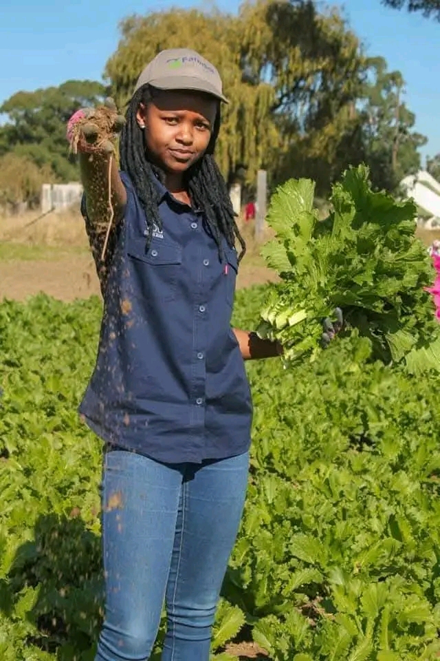
Years later, Njabulo Mbokane has grown from a small-scale farmer operating on a limited budget into the owner of a 200 hectare farm in Mpumalanga. Her business now supplies yellow maize to South African Breweries and cabbage and spinach to SPAR. The operation also creates employment through three full-time employees and 13 seasonal workers.
Behind that growth are practical lessons about resilience, scaling carefully, identifying market opportunities, and building a business step by step instead of chasing overnight success.
Starting Small Without Waiting for Perfect Conditions
One of the most powerful lessons from Njabulo Mbokane’s journey is that she did not wait for ideal circumstances before taking action.
After matric, she started selling fish and chips on the streets. That kind of business may seem far removed from commercial farming, but it helped develop entrepreneurial instincts that later became valuable. Street trading teaches important fundamentals: customer interaction, cash flow management, consistency, and persistence.
Eventually, she ventured into farming on a small scale and with very limited resources.
That decision reflects a mindset many entrepreneurs struggle to adopt. Too often, people believe they need major capital, perfect equipment, or outside validation before starting. Njabulo’s journey shows the opposite. Businesses can begin with whatever resources are available at the time.
The key is movement.
For aspiring entrepreneurs, this is an important reminder that starting small does not mean thinking small. Some of the strongest businesses grow gradually because their foundations are built through experience rather than shortcuts.
Why Agriculture Became a Smart Long-Term Opportunity
Njabulo Mbokane’s shift into farming also highlights the importance of entering industries tied to long-term demand.
Food production remains one of the most essential sectors in any economy. Regardless of economic cycles, communities still require staple crops and fresh produce. By building a business around maize, cabbage, and spinach, she positioned herself within a market connected to everyday consumption and national supply chains.
That strategic positioning created growth opportunities beyond local informal markets.
Supplying yellow maize to South African Breweries represents a major milestone because it demonstrates entry into structured commercial supply relationships. At the same time, supplying cabbage and spinach to SPAR reflects the ability to meet retail demand consistently.
Those achievements suggest reliability, production capability, and operational discipline.
Entrepreneurs can learn an important lesson from this: businesses often grow faster when they align themselves with industries that already have stable demand.
Scaling Through Consistency Instead of Hype
One of the most striking aspects of Njabulo Mbokane’s story is the steady progression from small-scale farming to owning a 200 hectare farm.
That kind of growth rarely happens instantly. It usually comes from reinvesting, improving operations, and maintaining consistency over time.
Modern entrepreneurship culture often glorifies rapid success and visibility, but farming teaches patience. Crops take time. Expansion takes planning. Relationships with buyers require trust.
Njabulo’s journey reflects those realities.
Rather than building attention through flashy branding, her business growth appears rooted in execution. Commercial buyers and retailers depend heavily on consistency because supply interruptions affect their own operations. By supplying major organisations, she positioned herself as a dependable producer.
That reliability became a business advantage.
The broader lesson is valuable across industries. Sustainable growth often comes from mastering operations before aggressively expanding.

Creating Employment as the Business Grows
Another meaningful part of the journey is the employment created through the farm.
With three full-time employees and 13 seasonal workers, the business contributes beyond profit generation. It creates livelihoods and economic activity within the community.
This highlights an important entrepreneurial truth: growing businesses eventually become ecosystems that affect many people beyond the founder.
Strong businesses create opportunities for suppliers, workers, customers, and communities. Njabulo Mbokane’s story demonstrates how entrepreneurship can evolve from personal survival into wider economic impact.
For young entrepreneurs especially, this is an important perspective shift. Building a successful business is not only about individual achievement. It is also about creating systems that allow others to benefit and grow alongside the business.
The Importance of Adaptability in Entrepreneurship
Another lesson from Njabulo’s journey is adaptability.
She moved from street food sales into agriculture, proving that entrepreneurial skills are transferable. The ability to recognise opportunity, solve problems, and commit to consistent work matters across industries.
Too many people believe they must remain tied to their original starting point. Njabulo’s journey shows that entrepreneurs can evolve into entirely different sectors when they identify stronger long-term opportunities.
That willingness to pivot often separates stagnant businesses from growing ones.

What Entrepreneurs Can Learn From Njabulo Mbokane
Njabulo Mbokane’s story is not built around shortcuts or overnight fame. It is a story of gradual growth, persistence, and strategic expansion.
From selling fish and chips on the streets to supplying major organisations through a 200 hectare farm, her journey reflects the power of starting with what is available and building patiently over time.
The biggest lesson behind her success may be this: sustainable businesses are often built quietly, through consistency, discipline, and the courage to keep moving even when resources are limited.